Landforms in Nicaragua
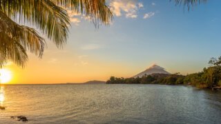
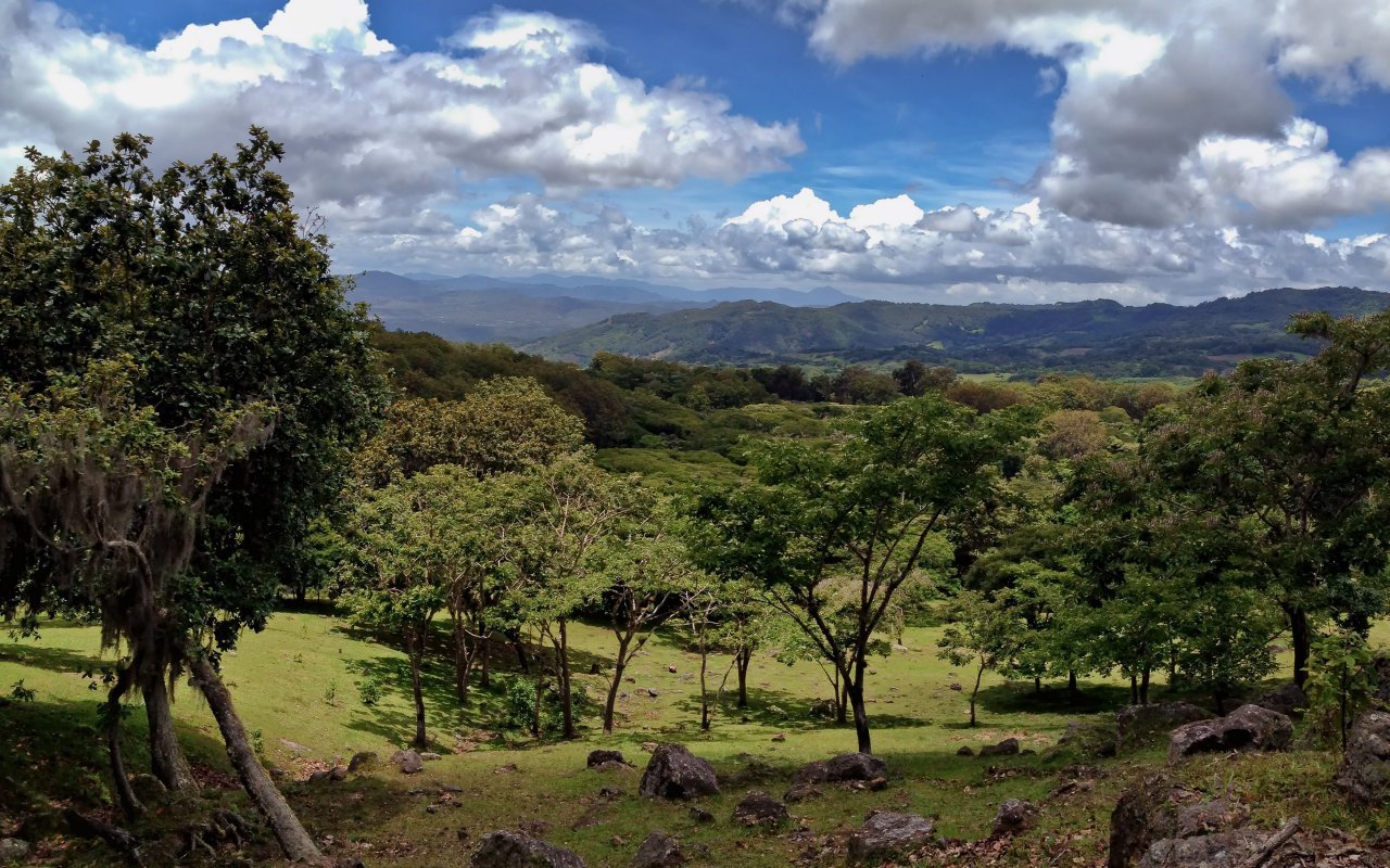
Nicaragua has the advantage of offering travelers a wide variety of landscapes. From the postcard-perfect Pacific and Caribbean coasts, to the more humid, forest-colored central part of the country, Nicaragua’sPacific and Caribbeancoasts are naturally sea-level coastal plains. In the south, on the border with Costa Rica, the land is more marshy. The landscape gradually rises towards the country’s central mountain range. The central lands of Nicaragua have an average altitude of 600 m. Among the most accentuated reliefs are two mountain ranges:the Cordillera de Maribios, which is the chain of volcanoes that emerges from the plain on the edge of the Pacific Ocean as far as the Xolotlan lagoon on the outskirts of Managua. This mountain range rises to an altitude of 1,700 m, with the San Cristóbal volcano.Nicaragua’s highest point is Mount Mogoton, at almost 2,450 m, part of the country’s 2nd highest mountain range (around 2,000 m): the Cordillera Isabelia. These mountains lie on the border between Honduras and Nicaragua, where the land is higher and cooler
Volcanoes in Nicaragua
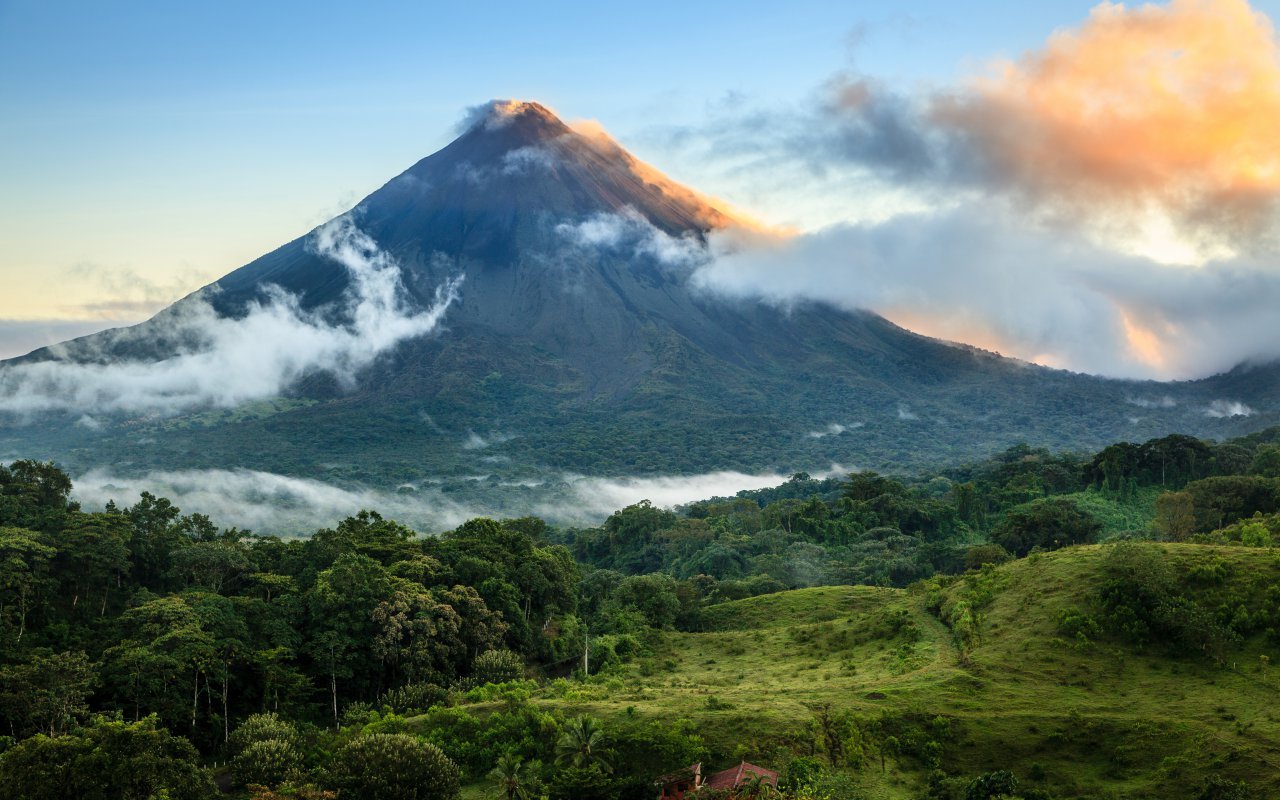
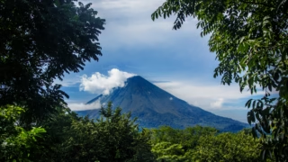
Nicaragua is home to more than twenty volcanoes. This is due to its geographical location, at the center of the Central American volcanic arc, more precisely in the Pacific Ring of Fire. With the exception of two that are a little further east, all lie on a line parallel to the Pacific Ocean, on the west coast, from the border with Honduras to that with Costa Rica. To the north-west, the Gulf of Fonseca, which is the dividing line between Honduras, El Salvador and Nicaragua, is dominated by the remains of the Cosigüina volcano (872m). Formerly 4,376m high, after one of its most violent eruptions in 1835 it fell to 845m. Further south, between Chinandega and León, lies the 60km-long Maribios range, where you can explore, among other things
- San Cristóbal volcano, one of Nicaragua’s highest at 1,745m above sea level
- Telica volcano (1,061m), perhaps one of Nicaragua’s most active volcanoes, with constant emanations of gas and steam. The volcano can be climbed, and you can also spend the night here to witness the spectacle of bubbling lava
- The one with the most lunar appearance, yet one of the lowest in the country, is the Cerro Negro volcano. Named for the color of its sand, it last erupted in 1999. The climb is relatively easy, and the descent unique in the world: on a board!
- The Momotombo volcano (1,297m) won’t let you into its territory, as it has been closed for some time now due to its constant activity.
Between the towns of Masaya and Granada lie other volcanoes, geographically close but with completely opposite environments
- The Mombacho volcano (1,344m), with its micro-climate, is home to the world’s last remaining tropical rainforest, and it is on its slopes that one of Nicaragua’s finest coffees is grown. Its last eruption formed 350 islets in Lake Nicaragua.
- The Masaya volcano (635m) is surely one of the most visited in Nicaragua, with its lava lake nicknamed « Boca de Infierno » (Hell’s Mouth), where ancient human sacrifices were made to appease the wrath of pre-Columbian gods. Indeed, it’s from the rim of its crater that you can observe the bubbling lava and smell the fumaroles that testify to the volcano’s liveliness.


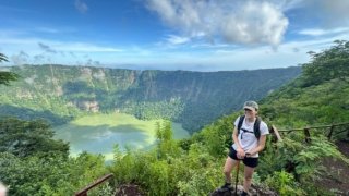
- The Apoyo volcano, now called Laguna de Apoyo because its former crater is now filled with water, has become a popular Sunday bathing spot.
In the middle of Lake Nicaragua lies the island of Ometepe, formed by two volcanoes
- The Concepción volcano (1,700m), with its casi-perfect conical shape, is still very active. It’s a steep climb, and a guidebook is a must, as many have got lost.
- The Maderas volcano (1,394m), whose flanks are covered with coffee and banana plantations, shelters a lagoon in its crater. Its thermal waters are renowned for their youthful benefits, and can be accessed a little further down at the Ojo de Agua pools.
Nicaragua's beaches
Between the Pacific and Caribbean coasts, there are plenty of places to swim and marvel. Nicaragua’s west coast is bathed by the Pacific Ocean, where the beaches are often black and the waves incredible. As a result, this coast is famous for surfing! Nicaragua’s beaches are famous for the gradation of colors in the sand. To the north, opposite León, are the beaches of Poneloya and Las Peñitas, where the sand is black due to the presence of volcanic soil. A little further south, you’ll find less-frequented beaches such as La Boquita and Las Salinas, where the sand is much lighter.

Although it’s known as the hottest spot on the Pacific coast, San Juan Del Sur, nestled in a bay, has kept its fishing village soul. To the south and north of San Juan del Sur are wonderful beaches, ideal for relaxing and surfing.
Playa Hermosa, Playa Madera, Playa Majagual and Playa Marcela are among the most beautiful, with the fewest accommodations. Towards the border with Costa Rica, you’ll find beaches that are also favorite nesting places for sea turtles: Playa El Coco and Playa La Flor. Then, continuing southwards, the small village of Ostional is the last before crossing the border with Costa Rica, where you’ll find an imposing beach. On the Caribbean side, the coast is much less populated and the beaches are a picture-postcard setting: white sand that could be mistaken for sugar, crystal-clear turquoise water and dozens of coconut palms whose curves invite you to relax. From the north to the south, you can indulge in the English-sounding village names of new generations of former West Indian slaves, whose features are more Afro than Amerindian: a people called Moskitos.
Make a stop at Bluefields for a view of the city, and another at the Pearl Keys lagoon for an ambience of paradise. However, to further isolate yourself from the world, you can escape to the Corn Islands. The largest, Big Corn Island, is 75km from the mainland, while the smallest is an hour’s boat ride further offshore.

There are no cars on Little Corn Island. Only the sound of the waves, the wind in the coconut palms and the warmth of the sun on your skin. The green of the palm trees, the white of the sand and the blue of the water, a trio of colors that makes you travel. There’s no time for boredom here, and no shortage of activities: scuba diving, snorkeling, wildlife observation, rum tasting, lobster barbecues..
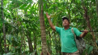
Tropical forests and nature reserves
Nicaragua’s natural areas cover almost 6 million hectares, or almost 30% of the country’s total surface area. This estimate includes the forest landscape, the majority of which is made up of tropical rainforest, dry forest and mangrove swamps. Nicaragua has a total of 71 protected reserves, representing a total of 17% of the territory (or 2.2 million hectares). Nicaragua’s two most emblematic reserves are the Indio Maiz Biological Reserve on the Rio San Juan, and the Bosawas Biodiversity Reserve
- The Bosawas Biosphere Reserve is located in the northern part of the autonomous Caribbean territories. It covers an impressive 2 million hectares. It was declared a Biosphere Reserve by Unesco in 1997, as it is estimated to contain 10% of the planet’s species. It is the most important reserve in Nicaragua and Central America, and the 3rd largest in the world. Formerly considered the lungs of the Americas, it has been deforested since the 2000s, and is now endangered.
- The Indio Maiz reserve covers some 264,000 hectares and is the country’s second largest reserve. It lies partly in the Autonomous Territory of the South. It is also in great danger, as it is subject to 60-70% deforestation and numerous abuses every year, in territories that do not belong to the indigenous Rama and Kriol territories. Nevertheless, it is considered Nicaragua’s best-preserved forest, home to more species of flora and fauna than the whole of Europe.
Nicaragua also boasts other reserves
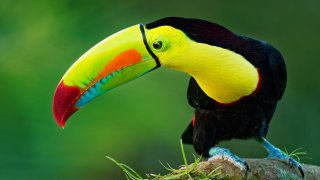
- The Los Guatuzos nature reserve, which lies along the border with Costa Rica, covers some 437 km². This little-visited reserve is home to more than 18 rivers, the majority of which are navigable and originate from the Rio San Juan, and boastsone of the highest concentrations of tropical birds in the world.
- Masaya Volcano National Park, which surrounds the volcano over 54 km², is one of the most visited parks, day and night. In fact, as well as offering an extraordinary spectacle at night with theobservation of its lava lake, during the day you can hike over 20km of trails in search of the many species of birds, such as the green parakeets that live close to the crater.
- The Miraflor Nature Reserve rises to an altitude of 1700m on the outskirts of Esteli and covers more than 254km². It covers more than 3 different climates, with vegetation ranging from dry forest, tropical rainforest and coniferous forest.
- The La Flor reserve is a refuge covering an area of 56km² of tropical dry forest on the shores of the Pacific. This area is declared protected mainly because it is the favorite nesting place of sea turtles every year. To prevent poaching, the reserve’s guardians collect the eggs and, 45 days after birth, return them to the water in their natural habitat.
This list is just a small sample of what can be discovered here, and includes the following reserves: El Chocoyero reserve, Cosiguina volcano reserve, Maderas volcano reserve, Selva Negra reserve, Peñas Blancas reserve, Mombacho lagoons and Apoyo lagoon, Juan Venado island reserve, Somoto canyon and many more..
Explore Nicaragua today!